
Project
Apex S-Line Mobility Hub Feasibility Study
Furthering Transportation Connections in Apex
A mobility hub is a place where different travel options – walking, biking, transit, and shared mobility – come together. Mobility hubs are meant to be places that connect people with regional and local multimodal transportation options, offering integrated facilities, amenities, technologies, and services. They offer choices to get you where you need to go, making it easier to transfer from one form of travel (like walking, biking, or using a scooter) to another (like carpooling, taking Uber/Lyft, using a bus or shuttle, or, someday, taking a train).
- Location
-
- Apex, NC
- Project Owner
-
- NCDOT + Town of Apex
- Services Leveraged
In 2024, the North Carolina Department of Transportation (NCDOT), in partnership with the Town of Apex, commissioned the Apex S-Line Mobility Hub Plan to explore feasible sites for a future passenger rail station.
Study Scope
- Understanding existing and future conditions
- Engaging the public to understand desired hub elements
- Identifying potential mobility hub locations
- Selecting a preferred location
- Developing concept plans and cost estimates
- Developing an implementation and funding plan
The team identified six potential locations for a mobility hub within Apex, and through a comprehensive process ultimately identified the preferred location considering:
- Platform and rail infrastructure requirements;
- Crossing closures when train is stopped at station;
- Multimodal connectivity to the site and surrounding area;
- Proximity and connectivity to surrounding community;
- Suitability for the future development of the mobility hub site and surrounding parcels; and
- Human and natural environment items for a Categorical Exclusion.
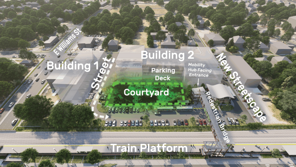
The preferred site supports a three-phased approach:
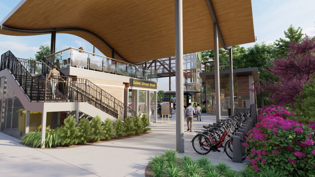
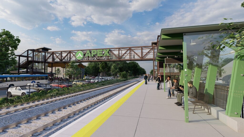
- Phase 1 – Potential to be constructed prior to rail service. Includes improvements to the existing parking lot and transit stop, pedestrian improvements along Moore Street, lighting, bicycle parking, and possible EV chargers. Includes bus layover spaces, secured restroom, and safety / security measures.
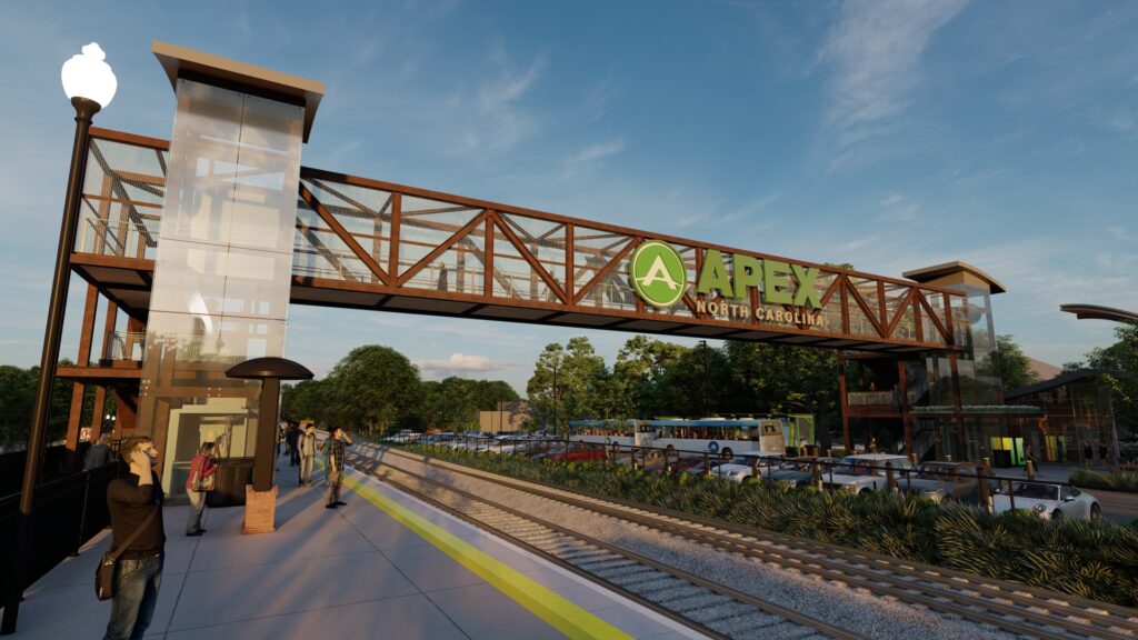
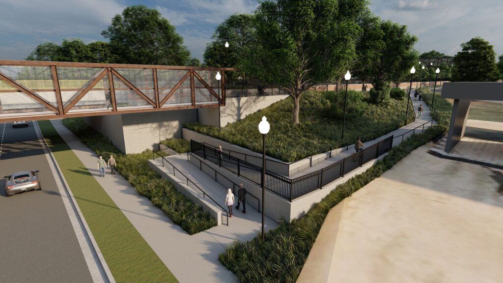
- Phase 2 – With rail service. Includes platform, additional security measures, café, restrooms, information office, and elevated crossing of the railroad.
- Phase 3 – Extension of Phase 2 with elevated crossing of East Williams Street.


The team also developed recommendations about how the mobility hub should be integrated with future redevelopment of the area.
The concept of mobility hubs in small to medium-sized municipalities that are not served by high-capacity transit is relatively new, particularly in North Carolina.
While passenger rail service is possible for Apex in the future, a mobility hub in Apex needs to provide mobility and community benefits in advance of rail service, but be scalable to accommodate future expansion to include rail elements. It was critically important to educate the public on the concept of a mobility hub and then to clearly understand the mobility and community elements that were important within the context of what the Town is now and what it is planned to become. This was accomplished through a robust public engagement process that included interactive public meetings at the beginning of the process that allowed for the public to plan for mobility hub elements within the context of space and monetary constraints, meetings with property owners adjacent to the mobility hub location, and engagement near the end of the process to solicit feedback on mobility hub phases and conceptual designs.


This feasibility study attempted to bridge the gap between the large target area identified in previous planning studies, and the design of the mobility hub itself, by considering site conditions such as access, utilities, topography, large trees, and surrounding developments. The project team utilized advanced 3D modeling techniques that allowed us to analyze and design around the site conditions, while providing key information such as construction quantities and renderings for communicating with stakeholders and the public.


